... And Back Again
**Updated Alaska Reports, and other Polar Flight 90 dispatches, will be provided from time to time over the summer, fall, and winter - as preparations continue for an estimated Polar Pumpkin takeoff date, to the Geographic North Pole, of April 1, 2012
MORE 2011 EXPEDITION:
2011 Expedition Part 1: Fairbanks Alaska to Eureka Station
2011 Expedition Part 3: Illinois to Alaska
See the 2011 Polar Flight 90 Expedition Map
April 26, 2011
|
|
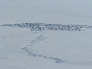
Eureka Weather Station to Resolute Bay
The day "dawned" bright and sunny - only in a manner of speaking - because at this time of year, at this latitude of 80N, there is really no darkness or dawn.
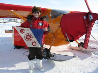
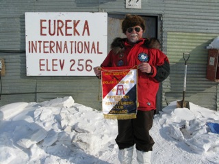
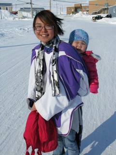
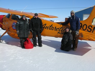
Checking the weather, I find that the route all the way from Eureka to Resolute is mostly in the clear. Resolute has some drifting snow and ice crystals - and a cross wind of approximately 15 knots - so I began preparing the airplane for the flight. I had previously rolled two full drums of fuel under the winds - as weighted tie downs; so these had to be removed and rolled back in place. Eureka weather station personnel are all so positive, cooperative, and helpful. After I had the wing covers pulled off - and was just getting ready to get in the airplane - Mike brought me some juice and fresh baked muffins. In addition, Mike also agreed to take a few photos of me with the Polar Flight 90 banner that my dear wife Damaris and made, the Explorers Club Flag #53, and the handmade banner from the Adventurers Club of Chicago.
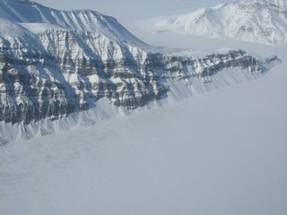
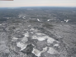
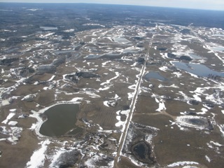
It was such a fabulous day for flying, that I stayed low for awhile - at approximately 2,000 feet - to improve my chances of seeing musk ox and/or polar bear, and also to lighten my fuel load before climbing over the mountains of Axel Heiberg Island. After leaving the south end of the island, the terrain flattens out to low rolling islands, and the bays and straits in between.
Sure enough, I got the crosswind at Resolute Bay. There is a secondary cross strip; but that one looked too wind blown with hard drifts - so I landed on the main runway of 17/35. I remember times in Kansas and Texas when the cross winds were so strong that I had to land on the taxi and/or parking areas. This, fortunately, I didn't have to do in Resolute today.
Azziz Kheraj once again picked me up at the airport; and, before long, I was enjoying a nice supper at his fine establishment, prepared by Chef Randy.
Later in the evening, Azziz gave me a ride to the airport and helped me put two full fuel drums under the Polar Pumpkin wings for tie downs in case the wind picked up even stronger.
Also, this evening, I had the opportunity to visit long time Ken Borek Air pilot and friend Mr. Henry Perk. Henry and I had worked together on the Arctic Research and Environmental Acoustic (AREA) projects in the Arctic Ocean back in the mid 1980s. It was a great pleasure to see him again; and to be riveted to his stories about pirate attacks on his sailing yachts the snakes of Burma, and many other stories. Henry - originally from Switzerland - is now a Canadian citizen; but one may wish to call him a "world citizen" - considering his experiences and flights/yacht voyages to so many remote corners of the planet.
April 27, 2011
|
|
Resolute Bay
A relatively calm, sunny, and glorious Spring day.
One of the first things I had to do today was get the Polar Pumpkin refueled. It's a fairly time consuming task fueling from drums, compared to refueling from a larger fixed fuel tank. First, I need to get my sweet little Honda fuel pump out of the back of the Pumpkin; and put it inside the terminal for warming, so I can get it started. As it's warming, I get out my series of hoses, nozzle, and bung wrench. On the last refueling at Eureka, it seemed that one of my in line filters was starting to get plugged - limiting the size of the fuel stream - so today I replaced both filters. Fuel sitting for prolonged periods - in varied weather conditions - sometimes has ice crystals in it. Definitely not to be introduced into the aircraft fuel system. In fact, besides filtering the fuel, I also add a bit of a "drying agent" such as isopropyl alcohol.
This evening the Polar Pumpkin is refueled for the flight tomorrow - or whenever the weather will allow - and the frost protective wing covers are put on as well.
The Canadian Polar Continental Shelf Program is headquartered at the airport here in Resolute; and, today, I was invited by one of the scientists to a tour of the facility and lunch after. Dr. Dale Andersen, one of my Antarctic colleagues, and valuable weather consultant for Polar Flight 90, bases from here on his scientific research project at Expedition Fiord on the eastern shore of Axel Heiberg Island.
It's a fabulous facility - with all the amenities to accommodate scientists' personal needs - and a wonderful laboratory for experimentation and sample storage. Any logistical item that one might need for a field project may be found in the PCSP warehouse. The program has at least one helicopter on contract; and also a couple Twin Otters on contract.
The lunch meal was tasty, the comraderie good, and the famous "wally bars" for desert absolutely fabulous.
100LL AvGas is a rare commodity in some smaller arctic communities - since most air transportation is via turbine powered twin engine aircraft; so today I called ahead to the village of Taloyoak to see if it was available there . . . no. So I called Cambridge Bay; and, as of this evening, I'm yet not sure. But for now, I'm next planning to fly to Cambridge Bay. I'll know more about the fuel situation there tomorrow.
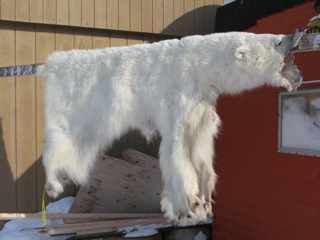
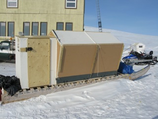
After returning to the South Camp Inn, from the airport, I had time to take a short walk around Resolute Bay. There was little wind; so many of the kids were outside playing on the large snow drifts. One thing that caught my eye were the hand made "camper sleds" - i.e. plywood and canvas camping shelters built atop the heavy duty "komatiks" - or sleds - that are pulled behind the snowmobiles. Clearly, in this area, Polaris is the snowmobile of choice. Such a shelter can provide quick and comfortable protection from the severe cold and high winds when "out on the land". Some of the land's harvest was evident at one residence, in the form of a fresh polar bear skin drying on a pole. A dehaired and washed seal skin was drying in front of another residence. The sun and wind will make these skins pure white. In the back of another house were whole frozen seals.
So many folks in our "modern world" - whatever that is - are so disconnected from the land and the natural life and death processes thereon. Here in Resolute - and other "subsistence communities' - these processes are more evident. Families need meat; so they shoot animals, and eat their meat. I wonder how many "modern" inner city kids know from where their meat - or milk - or eggs - or? - really comes.
Off to bed now . . . and we'll see what flying weather Mother Nature has in store
tomorrow.
April 28, 2011
|
|
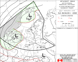
I couldn't help but check the weather at the North Pole first thing this morning: 1 to 5 miles visibility with snow, and ceilings down to 800 feet. Although I would have so liked to have achieved my goal of landing at the North Pole by now, I can be so thankful that I'm not stuck with the Polar Pumpkin on a drifting ice floe - and maybe a breaking ice floe - with the improbability of being able to fly back to land in such weather. I must believe that all things work out for the best in the long term.
I can't help but contemplate the name and legacy of Robert Falcon Scott, the British explorer that was in competition with Roald Amundsen, to be first to the South Pole. Scott is a national hero - and iconic name - in Britain. It is wonderful that Britain honors his name and legacy; but I believe that he has become so, partly due to the tragic loss of his life, and the lives of his team, on their retreat from the South Pole back to their base camp in a terrible blizzard.
It's a gorgeous day here in Resolute Bay; and, in checking the weather at Cambridge Bay, it appears that there's a chance that I will be able to fly later today. There are still light snow showers in the Cambridge Bay area - associated with a low pressure system - but these conditions are forecast to improve as the day goes on. One issue may be the possibility of freezing fog - with visibilities down to mile - caused, I think, by open water in the sea just to the southeast of here.
I had wanted to next fly to the village of Taloyoak - which earlier had been called Spence Bay. On another expedition with my Cessna 180, I had landed at Pelly Bay and Gjoa Haven (where early explorer Roald Amundsen spent with winter). These are villages just to the south and west of Taloyoak. Unfortunately, no AvGas was available in Taloyoak; so I must instead fly to Cambridge Bay to refuel.
Other residents here at the South Camp Inn include a British team that was competing in a ski race to the "Magnetic" North Pole - where all the magnetic lines of force converge. This Pole is not so difficult to reach as the Geographic North Pole - 90 degrees north. But, conditions can still be brutal, with cold temperatures, wind chills, and blizzard conditions. One of the British team here showed me his right hand last evening. Although he is not likely to lose any fingers to the frostbite, the finger tips were still swollen. In more severe stages of frostbite, the flesh dies, turns black; and the appendage must be amputated.
Later this morning, I'll be heading out to the airport to check the Polar Pumpkin; and - if conditions are good enough for the flight to Cambridge Bay - I'll take off.
April 29, 2011
|
|
Cambridge Bay to Baker Lake
Conditions were adequate yesterday for the flight from Resolute Bay to Cambridge Bay. I was skeptical for a bit, however; because just after takeoff, I found a wide area of low "undercast" fog that extended to the east over the open water of Lancaster Sound. It was necessary to remain "VFR ON TOP" for the first 40 miles of so. Most of the route was CAVU - with the sea ice pack being tight, and no additional fog. On arrival at Cambridge Bay, I had another crosswind of approximately 15 knots. Alex, the fuel vendor, already had my AvGas in drums set out for me.
Several years ago, I had flown my Cessna 180 through the Canadian Arctic - via Quebec, Baffin Island, and around the north end of Foxe Basin enroute back to Alaska. On that flight, I also stopped in Cambridge Bay, with the great good fortune of meeting the Laserich family. The grand patron, Willy Laserich, had sadly passed away about a year ago; but his son Remy was there to greet me on my arrival today - as was Willy, Gordon, and Brian. The family operates Adlair Aviation. Remy and Brian arranged accommodation for me tonight; and we both enjoyed the fabulous cuisine of Jesse Laserich and her friend Matt. Jesse's friend Pam - now studying cultural anthropology - was an amazing source of information regarding the lifeways of her ancestors on Victoria Island.
North Bay flight briefing reported this morning that there was a low pressure system 400 miles to the west of Cambridge Bay; but that a cloud shield had already moved across my route to Baker Lake. Thankfully, the Laserich team helped me set up my pump for refueling; and efficiently get me under way. Prior to coming to the airport, Brian and I researched the availability of musk ox and/or arctic char jerky at the local meat processor. Unfortunately, none was available. I find it interesting that the dried char specialty is called both "biffy" or "pipsi" - depending on the specific arctic locale.
The first hundred miles or so, crossing the sea ice of Coronation Gulf, were in clear conditions. But as I flew inland, the forecast "cloud shield" was indeed across my path. My maximum altitude was 2,000 feet; which put me approximately 1500 feet above the terrain. I needed to stay low in order to maintain ground contact. Prior to takeoff, I had checked the weather in Gjoa Haven; and since their weather was remaining good, that was my alternate diversion airport - in case clouds forced me to the ground. In conditions such as these, I'm thankful to also have on board a radar altimeter - which is not dependent on varying barometric pressure, and gives one the actual height above ground.
As a high school student in the small town of Stanton, North Dakota, I had read Farley Mowat's first book - "People of the Deer" - about his 1947-1948 study of the Ilhalmuit that supposedly traditionally lived in the "Barrenlands", over which I was now flying. The land is low rolling rocky topography, interspersed with hundreds of lakes. Judging by the large drifts of snow - everywhere - and nearly no flat spots on which to land a ski plane - it is a land of very high winds. How these "People of the Deer" could survive in such a land was absolutely amazing. Many didn't. Starvation was real. Remy Laserich called this land a "no man's land".
While flying the last 100 miles to Baker Lake, the weather improved; although there were occasional low clouds. On two occasions, I thought that I had found "springs" of water coming from the ground. One of these was near Garry Lake, a site of traditional Inuit encampments many years ago. Later, in Baker Lake, I was informed that what I actually had seen were sections of rapids in the river, where the water was kept open at all temperatures, due to its cascading velocity.
After two of the local pilots parked their single turbine Otter for the night, I was offered a ride to the Baker Lake Nunamuit Lodge. After an excellent supper, bed felt good.
 Ted and Renee - my copilot and navigator - took to the slopes during a short rest stop in Cambridge Bay. |
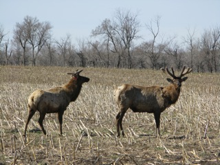
 They also made friends with one of the local "big boys" of the region. He was nice, they said; but a bit of an "ox" |
April 30, 2011
|
|
Baker Lake to Arviat to Churchill to Gillam
Baker Lake is a community of approximately 1700 mostly Inuit folks at the mouth of the Thelon River. Its Inuit name, Qamani'tuaq, translates to mean "where the river widens". The Hudson's Bay Company installed a trading post here in 1916; and the community's English name is given in honor of Sir William Baker - the 11th governor of the Hudson's Bay Company. Baker Lake is famous for it's art prints and soap stone carvings.
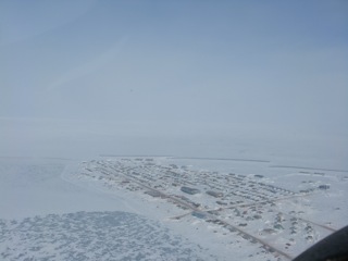
I was a bit anxious to get rolling this morning; because another low pressure system was coming in from the west - bringing more low cloud and snow. Shortly after takeoff, I got into these very conditions. In this part of the world - this time of year - most everything is one color - white; and it's very difficult to contrast the land with the horizon. As I flew toward Arviat, however, the weather did improve - as forecast; and was actually CAVU on my Arviat arrival. Paul, the airport radio operator, graciously directed me to a good parking spot for refueling. Pierre, another Inuit gentleman - who says his birth doctor must have been French - positioned my drum of AvGas immediately in front of the Polar Pumpkin. Pierre's Inuit name is Ikakhik Isitkuk. He was surprised when I told him my given Inupiat name of Tuluaq. As we parted, I used the words "taiku" and "koana" - both meaning thankyou; but neither worked with him. The local Arviat dialect for thankyou is "matna".
Pierre said that there was a snowmobile race in progress in Arviat; and I could hear them. I would have liked to attend the festivities; but once again "weather" made the decision. There is another low pressure system in southeastern Manitoba that is to affect my destination vicinity this evening. So off I went - low level - with the Polar Pumpkin along the western shore of Hudson Bay. I was looking for polar bears; but sighted none. Most of the bears, at this time of year, are still far out in Hudson Bay hunting. Later, in the Autumn, many more bears congregate along the Hudson Bay coast. Paul, at Arviat, said that he saw 14 bears in one day. He also said that he has noticed distinct climate change; and that he has now seen robins and other unusual bird species at this high northern latitude. I asked Paul for an on camera interview; but declined, since, he said, he was "camera shy".
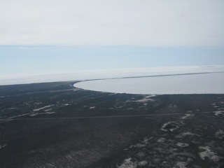
One of the more exciting events of the day was the "re-intersection" of the treeline - just north of Seal River as it enters Hudson Bay from the west. I had not seen a tree for the past few weeks, as I traveled in the very high Canadian Arctic. The closer I got to Churchill, the more trees I saw. I love trees.
Churchill is at the mouth of the Churchill River; and provides a seaport for the import of varied goods from around the world - connecting with the Canadian Railroad, for shipment to the interior of Canada; and also for the export of Canadian grain to customers around the world. Although I knew I would not have an opportunity to see polar bears in the Churchill vicinity, I landed anyway - to stretch my legs and have a cup of coffee.
Churchill weather was good; but I didn't have to fly far south before I intersected the cloud shield from the approaching Manitoba low pressure system. With the clouds came turbulence - not bad - but a bit of a bump now and then. It was great to be in an area again where I could actually see flat undrifted places on lakes and rivers; where I could land the Pumpkin if I had to - and, of course, firewood, in case I had to make a camp.
The community of Gillam is located on the shores of Stephens Lake - comprised to a large degree of Manitoba Hydro workers. In the vicinity there are at least 3 hydroelectric facilities. It is traditionally the land of the Fox Lake Cree Indians. With the low price of furs - and the high cost of supplies - trappers are not "on the land" so much as they used to be. Patrick, with Gillam Air, met me at the airport; and gave me a ride to the Gillam Motor Inn.
May 1, 2011
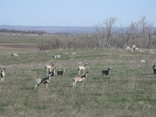
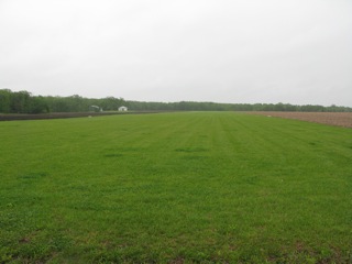
 The community of Arviat, Nunavut, near the western ice edge of Hudson Bay. |
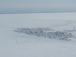
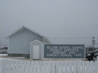
Gillam, Manitoba
Forecasters were right. Blizzard conditions with 3/4 mile visibility and snow in Gillam this morning. I didn't go far from the motel; but, after breakfast, I had the pleasure of a church service at the Gillam Gospel Church. It's a vibrant congregation of approximately 20 friendly souls.
Later this afternoon, however, the weather improved; and I was able to give some attention to the Polar Pumpkin. It rocked in the wind; but the tie downs held well. I have been, lately, having a few "issues" with the on board hyperspectral camera computer. Cold temperatures, stiff cables, connectors, etc. may have been part of the problem; but, after a telephone call to my colleague Ken Copenhaver at the Univeristy of Illinois, I think we have the solution to another one or two issues.
As I look out the window this evening, I see patches of blue; so I'm hopeful that the Polar Pumpkin and I will be once again on our way tomorrow.
|
|
May 2, 2011
Gillam, Manitoba to Swan River, Manitoba
Another snow storm hit the Gillam vicinity about the same time that I arrived at the airport. So, I thought, here goes another gallant attempt at flying; but one that will have to be aborted due to weather. Sam, a Gillam Air pilot, was at the airfield preparing their twin engine Islander for a flight to Kelsey with Manitoba Hydro personnel; so he was handy to help me get refueled. In the time transpired to get fuel, sort gear, and load the Pumpkin, the weather again had picked up to flyable status.
Enroute south, however, I did get into areas of poor visibility with snow. Fortunately, these were short lived; and, as forecast, weather improved the farther south I flew. The "bush" country - sparsely populated wilderness - over which I flew, contained thousands of lakes - most small, but some very large. Interspersed between a number of these lakes were cut trails in the trees that provided "portages" for those canoeists that wanted to travel from lake to lake. Lakes were melting to the point that it would have been impossible to support the Polar Pumpkin for an emergency landing. In that case, I was looking for a beach or a more shallow lake with swamp grass for a "Plan B" airfield.
My flight course clipped the extreme northern end of Lake Winnipeg. In looking toward the south end of this vast inland water body, one could see no horizon other than more water. As I neared Swan River, the bush terrain changed to agricultural fields and pastures. Although Swan River is to a great extent agricultural, there are also, for example, timber and logging companies that take advantage of the forest products available in the surrounding hills. In the airport lobby hung an outstanding mounted trophy whitetail buck.
A Piper Cherokee landed immediately behind me; and I was preparing to refuel, the pilot Andy Maxwell came over to help me. This gracious hospital behavior is so typical in Canada. Once again, I must expound on the good fortune of America - having Canada as a neighbor. After refueling, Andy - and his beautiful wife April - invited me to their log home in the country for the night.
The Polar Pumpkin was the only aircraft tied down on the parking ramp for the night - thereby attracting a bit of attention from local folks, including Caitlin, a local newspaper reporter.
May 3, 2011
|
|
Swan River, Manitoba to Minot, North Dakota
American Customs and Border Patrol agents come in all shapes, sizes, and attitudes. Unfortunately, as a group, they seem to have garnered a reputation for being especially rude, arrogant, hostile, and impolite. In my experience, this reputation is well deserved - especially in comparison with Customs Agents in Canada.
Last evening I struggled, once again, to complete an online based eAPIS reporting procedure that must be completed - online only - for all aircraft leaving and entering the United States. This, supposedly, could be a relatively simple system for those more familiar with computers than myself. I would argue that it is not a simple straightforward system. Some of the Canadian pilots with whom I spoke informed me that they, and some of their friends, will no longer fly to the United States due to this very cumbersome system.
The particular Customs Agent, with whom I spoke by telephone - and dealt with on site at the official airport of entry in Minot, North Dakota - was a particular breath of fresh air among his CBP colleagues. This individual was efficient, friendly, polite, and helpful. Employees at the BP refueling station and pilot lounge were of the same temperament. Shortly after arrival - using the airport courtesy car - I was enjoying a nice lunch at the Rolling Pin restaurant.
Due to the very high winds - and forecast of diminishing winds tomorrow - I decided to leave the Pumpkin parked into the wind, and spend the night in Minot.
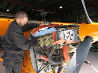 Expert mechanic, at Dakota Helicopters, Bo Klindworth doing an oil change and inspection on the Polar Pumpkin. |
May 4, 2011
Minot, North Dakota to Beulah, North Dakota
While flying small aircraft in the Alaska bush, and in remote sections of the Arctic and Antarctic, one normally need not be concerned with aircraft hitting cell/radio/tv towers. In more populated areas, however, one must keep a constant vigil for such a possibility, and/or insure ample altitude to fly above the highest of such obstacles. Enroute from Minot to Beulah there were a few towers - as well as smoke stacks from lignite generating/gasification plants. Lake Sakakawea - that body of water behind the Garrison Dam, on the Missouri River - was mostly open water today, with yet some large pans of drifting ice. Snow fall - and subsequent Spring runoff - was above average; so the lake was extra high. Soon a multitude of fishermen, and other water "recreators" will take advantage of its beauty and aquatic resources.
Immediately upon arrival in Beulah, Bo Klindworth - with Dakota Helicopters - got the Polar Pumpkin into their clean spacious hangar for an oil change and inspection. Thus far, from Fairbanks, Alaska - via extreme Northern Nunavut, Canada - to Beulah, North Dakota, the Polar Pumpkin had flown 37 hours.
May 5, 2011
|
|
Beulah, North Dakota to Theodore Roosevelt National Park
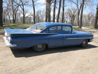
In 1967, $150 bought me a used - in good condition - '59 Chevrolet Biscayne 4 Door. I used the vehicle for several years - including during a portion of my time at university. Many years passed - while I was in Alaska - with the Chevy sitting in a neighbor's cow pasture. With so many nostalgic memories connected to this ol' "bucket of bolts", I may have put practical judgment aside, by deciding to restore the vehicle. Nowadays, however, when I pull up to a gas pump, I frequently get positive comments about how original and well done was the restoration. But, to me, the old car is primarily a bundle of memories; and a way to get from Point A to Point B - slowly.
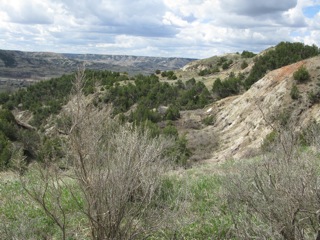
While the Polar Pumpkin and I flew about the Arctic the past few weeks, the primary color of the landscape- and most often the only color - was white. The Badlands of Western North Dakota - an area that I explored often as a university student - portrays a multitudes of colors, in the eroding butte topography, and with the varieties of cedars trees, cottonwood trees, and willows. So . . . as a treat to myself . . . and as a bit of "after-expedition-r&r", I decided to take a road trip in the '59 Chevy.
Theodore Roosevelt National Park comprises a good chunk of the Badlands - in the South Unit and North Unit. I was headed to the North Unit. A hiking/horseback trail, along the Little Missouri River, connects the two units. Since we're still "pre-tourist season", I was confident that I would not only find a campsite; but likely have few if any other folks nearby. In past years, even driving to the Park, one would see very little traffic. Nowadays, however, it's a very different story. A major oil discovery - in the Bakken Formation - is now being tapped. Many drill rigs, equipment staging areas, and oil trucks are changing what was once a very quiet agricultural environment.
The Badlands - besides its scenic beauty - provides visitors with opportunities to view mule deer, whitetail deer, bison, mountain lions, beaver, coyotes, and much other wildlife. The campsite that I picked in the north unit was near a beaver dam; so all through the night, I could hear the waterfall going over the dam. Both the buffalo and Texas longhorn cattle, within the park, are majestic to view; but - be warned - they are extremely quick, strong, and dangerous. In one case, when - in my "previous life" - I worked as a National Park Ranger, one of the feisty bison in Custer State Park hooked his horns under a car's bumper, and shook it around a bit - with passengers inside.
Just before leaving Theordore Roosevelt National Park - and heading back to tend again to the Polar Pumpkin - I hiked down to the Little Missouri River to . . . just sit for awhile, and soak in the beauty. Down the river flew two Canada geese, squaking and honking - or whatever they do - probably looking for the ideal nest site this time of year. Immediately across the river, a herd of whitetail deer jumped up in a patch of willows - and headed for better cover. The scene was the epitome of tranquility . . . and may that never change.
May 6, 2011
|
|
Theodore Roosevelt National Park to Bismarck, North Dakota
North Dakota has a long history of farming and ranching. In the latter part of the 19th century, many immigrants came from Norway, Sweden, Germany - and other countries - to homestead this prairie land. Some of these ranchers took up residence in the Badlands; and one of these was the notable Theodore Roosevelt. They were a tough lot. Access was difficult - especially up until the railroad was completed. Folks fought grasshopper infestations, drought, tornados, prairie fires, and isolation. But, at the same time, these difficulties brought folks together - depending on one another, and helping one another. Even today, there is a preponderance of folks that would just as soon see FEMA, and other government relief/welfare programs, go elsewhere. "We can take care of ourselves.". I have often said that the self reliant attitude of Midwestern folks is the "glue that holds the rest of the country together".
As I headed east from the Badlands, I passed through communities such as Killdeer, Halliday, Dunn Center, Dodge, Zap, and Golden Valley. Some of these little towns we played in basketball when I attended high school, in Stanton, North Dakota. Most have changed little . . . until now . . . until the oil boom. I pulled into Killdeer, for one of the most fabulous blackberry malted milks that one could imagine. There was the "Zip to Zap", at Zap, North Dakota, that received international media attention - when overzealous college students wrecked a portion of main street, during their Spring Break "release" - the Fort Lauderdale of the North!
Fort Clark, North Dakota now has a population of likely less than 10 souls. In former times, however, it was a thriving "metropolis" - with access by the railroad, and by sternwheeler steamboats on the Missouri River. Although no services are currently being held, the Nazarene Church building stands proudly against the rolling prairie background. The last commercial service available in Fort Clark was the combined general store and post office, operated by Ms. Mabel Craft. Nowadays, a modern highway cuts close to the settlement; and the traffic - usually whizzing past - pays no mind to the importance of this once vibrant little community.
Explorers Lewis and Clark passed through this area during their 1803-1804 voyage of discovery. In many locations - usually on higher bluffs overlooking the river - one can still find evidence of encampments of Mandan, Hidatsa, and Arikara Indian villages. While growing up on a local farm, we would - of course - till the fields; and oftentimes, find flint arrowheads, trade beads, bone tools, and stone hammer heads from these early Native Americans. Fortunately, archaeological sites are now preserved and protected by state historical societies, and - for example - the Knife River Villages National Historic Site.
Bismarck, North Dakota is the capital of the State - and the home of Herr Doctor Noel Boyko, and his wife Lynette. It was expedient that I make a stop at the Boyko residence - if, for no other reason - than to get the latest intelligence on the whereabouts of ring necked pheasant concentrations . . . and the biggest North Dakota walleyes.
May 7, 2011
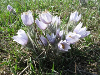 Pasque flowers - or "crocuses" - are some of the first to show themselves in Springtime on the North Dakota prairie |
Bismarck, North Dakota to Beulah, North Dakota to Vermillion, South Dakota
Weather forecasts indicate a system approaching from the west, with the possibility of several days of precipitation and low cloud. So - acknowledging the flexibility and graciousness of Bo Klindworth at Dakota Helicopters - the Polar Pumpkin was pushed out of the Beulah hangar, refueled, and prepared for a flight to points south. Illinois was my destination; but I needed to refuel enroute. So I picked the airfield at Vermilion, South Dakota. I had landed at Vermilion before, I was familiar with the area - and fuel was available by credit card 24 hours per day.
Maybe I'm just lucky . . . with often headwinds both going and returning! Today I had a strong headwind much of the way, with wind slacking as I approached Vermillion. With the strong winds came a fair bit of turbulence - not severe, but a steady moderate. So the flight wasn't that much fun. Enroute - at an alitude of 4,000 feet - I had a good view of the prairie habitat. Amid the rolling prairie hills, there are hundreds of cattail encircled "sloughs" or "potholes" - fabulous habitat for ducks and geese. The Central Flyway for migratory waterfowl is through this area. Today, however, all potholes were filled with water, many county roads disappeared into overflowing lakes, and some farmsteads were surrounded by water. It must be a tough Spring for those farmers and ranchers that are endeavoring to "calve" and/or put in their crops. Waterlogged North Dakota "gumbo" soil will capture farm implements readily.
Just prior to descending into the Vermillion area, I had a quick look for our family farmstead - and the Mortvedt cemetery. It took a couple minutes to find these landmarks - since airborne views of farmsteads look much the same - but find them I did. After a single low pass for pictures, I landed at Vermillion - greeted by more wholesome Midwestern hospitality.
I had . . . really . . . come home.
May 8, 2011
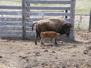 Bison - a lean meat - is popular among health conscious consumers. In former times, millions of bison roamed the prairies. |
Vermilion, South Dakota
Very strong easterly winds - to the tune of 35 to 45 knots - are forecast; so today the Pumpkin stays on the ground well protected inside a local hangar.
"Nostalgic" may be the best word to describe my visit back to Vermilion. I was born here - a number of years ago. Mother and Dad operated a diversified farm north of Vermilion, near a prominent landmark called "Spirit Mound". It is a "hill" - only 100 feet above the surrounding terrain - that the local Sioux Indians traditionally called Paha Wakan. Other tribes - the Omaha and Otoes - also considered it a legendary location where "little men" lived. These people were supposedly able to shoot sharp arrows long distances; and would kill anyone that ventured close to Spirit Mound. Our farm was located very close to the north side of Spirit Mound; but none of our family ever experienced an attack by these legendary warriors. On August 25, 1804, explorers Lewis and Clark - with 9 men, and Lewis' dog Seaman - walked 9 miles from their camp on the south bank of the Missouri River to climb Spirit Mound. Other than Seaman succumbing to the heat and humidity, none of the party suffered any difficulties during their climb. The Journals of Lewis and Clark note the varied herds of buffalo grazing on the prairies in the vicinity. It is interesting to consider that other Native American cultures note "little men", with supernatural powers. For example, the Inupiat Eskimo people - near where I now live in Alaska - tell stories about little men that inhabit a mountain called Tupqaruk, located just west of our wilderness lodge at Selby Lake. My long time Inupiat traveling companion, Mr. Joseph Harvey - prior to his death - insisted that he heard these "little mens", as he said, accessing Tupqaruk through the doorway that Joseph believed must exist at the base of the mountain. Tupqaruk is a derivative of the Inupiat word Tupik - meaning house. Tupqaruk has a distinctly sharp pointed summit, appearing - from a distance - much like the pointed peak of a tent.
My traveling partner today is Martha Peterson; who grew up at an adjacent farm just across the road from ours. Martha now lives in Vermilion. Two local pilots - Dave Howard, and his friend Tessa - invited Martha and myself to lunch at a restaurant in Spink, South Dakota. The population of Spink may be 2 persons - or 4 or 6 - but, most certainly, less than 10. The restaurant, in former times, was a local general store for the community. After lunch, we made a brief stop at Dave's farm, hangar, and grass airstrip. Dave had invited me to land the Polar Pumpkin there, if I needed hangar space. For now, the Pumpkin is well protected inside a hangar at the Vermilion airport - just in case thunderstorms get severe, with hail.
Other stops on our road trip today were at the graves of my Grandmother and Grandfather at the "out in the countryside" cemetery near the Dalesburg Baptist Church, at the Marshalltown country school where Mother walked across the fields to attend, and at the official "Mortvedt Cemetary". Quite a number of family members are buried there - about a half mile north of our family farm - and several of these relatives had emigrated from southwest Norway by sailing ship in the 1860s, to this black soil "land of opportunity" in southeastern South Dakota.
Although Mother and Dad left South Dakota - in favor of a new farm along the Missouri River in North Dakota - when I was 5 years old, many of the old buildings at our farm near Spirit Mound remain. One of the memories still quite vivid in my mind, was - as a 5 year old - sitting in the fuselage of my uncle's biplane that was built in the late 1920s, stored in the farm corn crib, fantasizing about being a pilot someday. Little did I realize that years later I would be flying the Polar Pumpkin Cessna 185 over that very spot, returning from an attempt to land the Polar Pumpkin at the Geographic North Pole.
May 9, 2011
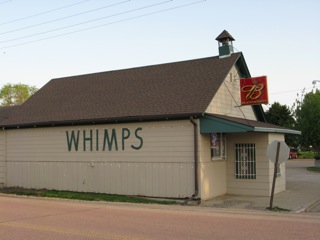 Whimps Burbank, South Dakota restaurant - home of excellent catfish and home made coleslaw. |
Vermilion, South Dakota
More wind - from the southeast - up to 35 knots at 3,000 feet. A direct headwind - so I decided to leave the Polar Pumpkin in the hangar for the day. This evening the wind is still blowing; but clearing skies indicate a possible flying day tomorrow.
Vermillion is located along the Vermillion River - near the confluence with the Missouri River. The water in these rivers is silty, indicating excellent habitat for channel catfish. The rumor is that there may be a special restaurant in nearby Burbank, South Dakota that serves catfish.
So, this evening, I shall do a bit of "culinary exploration".
Yes, indeed, Whimp's Restaurant had the catfish - and home made coleslaw, as well!
May 10, 2011
|
|
Vermilion, South Dakota to Macomb, Illinois
Having slept the night on the couch of the airport terminal, I was ready to go early in the morning - having gotten a favorable weather report from flight service briefing. It was interesting to note the performance difference of the Polar Pumpkin from the dense cold arctic air to now the hotter more humid air of the Midwest. The aircraft quite readily "leapt off the ground" in the Arctic; but was a bit more sluggish - and took a longer takeoff run - here in the Midwest. I was well within the limits of safety in both locations; but it was more desirable - and easier on the Pumpkin - to climb to cruising altitude more quickly.
I always enjoy the landscape while flying across Iowa - with a multitude of family farms, the tall corn silage "silos", and the myriad of small towns. Today, however, the haze was so thick that I was only able to enjoy the topography under the Pumpkin, with little forward visibility. The air was smooth for most of the flight; but, occasionally, I would hit a "bump in the road". For fun - and also to check my onboard HF radio - I would check in with the Ham Radio Maritime Mobil Net on 14.300 Megaherz.
Winds at Macomb were from the south at approximately 15 knots; so I decided to use the grass cross runway, instead of the pavement. I was glad that I did; because, later, I discovered that a nut had worked its way off of the retaining ram on my tail ski. It was easier on the ski to dig into the turf and grass than it would have been to dig into the pavement.
The Polar Pumpkin has served me well - carrying me safely nearly 5,000 miles from Fairbanks, Alaska through the Canadian Arctic Archipelago to Eureka Weather Station (80 degrees North/86 degrees West); and then on south along the west shore of Hudson Bay to North Dakota, South Dakota, and Illinois. The aircraft is now tucked away safely in a hangar; and can take a well deserved rest, while I fly with the airlines back to Alaska to operate the Peace of Selby Wilderness Lodge over the summer. The Pumpkin and I may make a short visit to Oshkosh, Wisconsin for Airventure 2011, during latter July and early August. Preparations are already underway to Point the Pumpkin North next April, for a second attempt to land the aircraft at the Geographic North Pole.
Polar Flight 90 has learned a great deal in its first attempt at the Pole - regarding aircraft performance, weather, topography, inter island sea ice status, Inuit communities, polar science, and much else. Microbial samples have been collected for the University of Innsbruck, improvements must be made in cold weather operations of the hyperspectral imager, and aircraft video camera mount locations must change in order to minimize the impacts of cold on battery longevity.
One aspect of Polar Flight 90, that will never change, is my sincere gratitude for those folks and institutions supporting the expedition - in whatever manner possible - financial, an encouraging word, a smiling face, a warm thought. As a team, we have accomplished much, thus far. If you believe in the goals of Polar Flight 90 . . . and wish to "hang in there" with me . . . WELCOME ON BOARD POLAR FLIGHT 90 - 2012.
Don't miss our 2011 Expedition Photo Album